
Trace a Rahway Street by Address
A street-by-street search in Rahway begins with the official form of one address, rather than a person’s name. Confirm the municipality, postal label, block and lot, and parcel geometry first. The assessment record and GIS are useful for current property context. The Clerk index then supplies dated instruments, while local printed material may add an earlier reference. A street name can cross a municipal boundary, so a Rahway mailing address should not be treated as proof of city jurisdiction.
- Enter the address in the Rahway-linked assessment search and retain the returned address, block, lot, assessment date, and any tax-roll owner shown.
- Use the Union County map service or NJGIN Property Explorer to check the parcel against roads, blocks and lots, wards, and zoning layers.
- Search the Union County Clerk index by the relevant party name once an assessment or deed supplies a name. Save the party role, document type, recorded date, and instrument identifier.
- For a current registration question, use the New Jersey status screen only for the user’s own record. Direct public-file questions to the Union County Board of Elections, where redactions and statutory limits apply.
- For an older address, compare the numbering map, a date-labeled directory or newspaper, and a Sanborn map before treating two numbers as the same place.
This sequence keeps the street directory grounded in address evidence. It also separates a current parcel match from a dated name in a printed or recorded source.
Rahway Street Directory Assessment Fields
The Rahway Tax Assessor works from City Hall, while the city links users to a statewide assessment interface. Its dynamic full screen was not fully documented in the research, so it is safest to use the documented address, property, and name routes without promising an unverified advanced control. A result can show a tax-roll owner, block and lot, assessment, tax, and class. It is a dated assessment record, not a complete description of a building or proof of who is there now.
| Rahway search or result field | Use in an address search | Important limit |
|---|---|---|
| Address, property, or name | Find the current tax-roll entry through the statewide interface. | The live dynamic screen can change. |
| Address and block/lot | Anchor the street location before moving to GIS or deeds. | Preserve the search date. |
| Owner, assessment, tax, and class | Read the certified tax-roll snapshot and assessment facts. | Ownership transfers after annual certification can lag. |
| Physical characteristics | Request the property record card when fuller detail matters. | The public view omits room count, building class, and the residential cost approach. |
Rahway identifies the property record card as the route for those omitted characteristics. A narrow OPRA request can name the address, block and lot, record sought, and date range. OPRA provides existing records subject to exemptions and redaction; it does not require a custodian to create an answer.
Note: Pair an assessment result with a recent recorded deed when the timing of ownership matters.
Map a Rahway Street With GIS
The Union County Public Map Service is the strongest official map route for a Rahway street directory. Its layer catalog includes Parcels, Blocks and Lots, Roads, municipal wards and districts, tax-map attachments, county zoning, parks, rail lines, and natural features. Turn on only the layers needed to orient the address, then record the service name and map date with any result. The display helps compare a parcel with the surrounding street pattern.
NJGIN Property Explorer provides another parcel route, with address, county, municipality, block, and lot fields. Both sources describe geography rather than legal title. The county map and statewide parcel data are not surveys, and NJGIN cautions that county data may not edge-match. Hosted owner names can also be redacted under Daniel’s Law, leaving a parcel shape without a public owner label.
Rahway Street Numbers and the 1964 Map
Chapter 157 makes the revised August 25, 1964 Official House Numbering Map and the Official Tax Atlas Rahway’s legal numbering references. The code uses a baseline and ten-foot units. When traveling away from that baseline, odd numbers are on the right and even numbers are on the left. The City Engineer determines the correct number. These rules make the official map more useful than a casual modern map read when a directory or deed uses a number that does not immediately match.
The code also sets out the way a numbering change is made. A proposal requires a map of the full block, owner notice or publication, a Council resolution, and an authenticated filing with the City Engineer. That filing supersedes earlier maps. Keep the source date, nearby intersections, and the original number in a research note. No official source located a citywide pre-1964 conversion date, so an earlier number should remain unresolved unless a primary map or municipal record connects it.
Note: Preserve the original number and source date before attempting any map or record conversion.
Rahway Street Directory Address Terms
Address records use different labels for the same place. Treat each label as evidence with its own purpose and date, then compare the block and lot before making a match.
- Parcel
- A mapped land unit identified through parcel geometry and often linked to a block and lot. It is useful for orientation, but the GIS shape is not a survey.
- Situs address
- The street address used to identify the physical property for an assessment or map record. It can differ from a mailing address.
- Plat
- A land map or plan referenced in property records. It is distinct from an online GIS display and may need a recorded map or legal description for a legal question.
- Criss-cross directory
- An address-arranged directory format used to work from a street to printed entries. No official searchable Rahway reverse-directory screen was located, so do not assume one exists.
The legal description, source date, and block/lot make a stronger match than a street label alone. Postal, mapping, assessment, and recorded-address labels can legitimately differ.
Follow Rahway Street Deeds in UCPA
The Union County Clerk Document Index supplies the dated instrument trail after an address search produces a party name. During research, the online index displayed coverage from June 1, 1977 through August 25, 2026. Its Name Search uses a surname, date range, party type, and at least one document type. Last-name matching can be Exact, Starts with, or Soundex; first-name matching can be Exact, Starts with, or Contains. A separate Instrument Number search takes year, prefix, instrument number, and suffix.
Record whether the party is a grantor or grantee, plus the document type, recorded date, instrument number, book/page when shown, page count, and image availability. A deed identifies transfer parties and a legal property description. Mortgages, liens, assignments, discharges, and foreclosure instruments connect names to property records but do not establish present association with an address. The Clerk’s physical land-record room reaches back to 1857, while imaging for documents before January 1986 was still in progress.
Use the Clerk’s Name Search to see the party-search interface before entering a precise query.
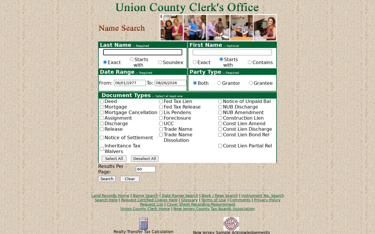
The controls shown there support a dated instrument search after the street address has been matched to a parcel and a named party.
Rahway Street Records by Address
A Rahway street directory is a chain of address-keyed records, not a single roster. The table separates what each source actually records from what it does not establish. A block and lot is the most useful bridge between current assessment information, GIS, permits, and a deed’s legal description.
| Address source | Rahway street fact | Time frame | Access route |
|---|---|---|---|
| Assessment roll | Tax-roll owner, address, block/lot, assessment, tax, and class | Annual certification snapshot | Statewide search, assessor, or OPRA property card |
| County GIS and NJGIN | Parcel geometry, roads, blocks/lots, wards, zoning, and map context | Current layer display | Map service or Property Explorer |
| Union Clerk instruments | Dated transactions, parties, legal descriptions, and document metadata | Online display from 1977; record room from 1857 | UCPA, record room, or copy request |
| Rahway SDL permits | Permit, control, project, owner, address, and status fields where displayed | Portal record | SDL or a specific municipal request |
| Numbering map and code | Official number order, baseline, and renumbering procedure | Current code and 1964 map | Code, map, City Engineer, or OPRA |
| Directories, newspapers, and Sanborn | Year-labeled printed names, business references, or structure context | Source-specific | Library, institutional scans, and LOC maps |
SDL permit documentation is only partial in the research, so its listed fields should be treated as portal or request leads, not as a promise that every permit will display every value. A specific request can identify the address, record type, block and lot, and date range.
Rahway Street Deeds by Recorded Date
When a name search produces many results, the Clerk’s date route can narrow a street-history question to the likely transfer period. It uses a document-type selector, from and to dates, party type, and results-per-page setting. A known instrument can be retrieved by its separate instrument fields. If the image is unavailable, preserve the metadata first and request the instrument rather than guessing from a result title.
For a certified copy, the Clerk’s documented schedule is $8 for the first page and $2 for each additional page. The request list identifies the instrument number, document type, recorded date, and page count. Check the current Clerk fee page before ordering because services and schedules can change.
The UCPA Date Search shows the date-range interface used for this part of a Rahway street directory search.
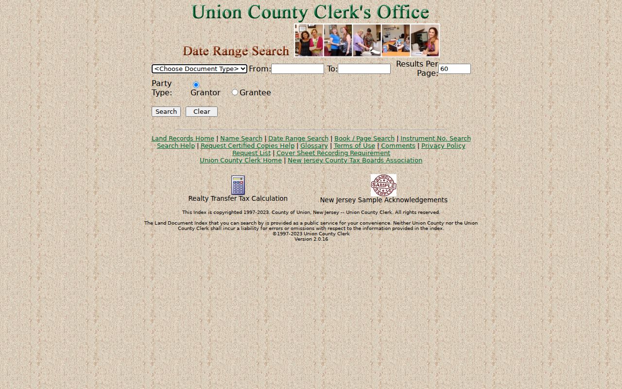
A date-limited result is still an index lead. The recorded image or certified copy supplies the underlying instrument when its wording matters.
Note: An online index result without an image may reflect the pre-1986 imaging gap, not the absence of the record.
Rahway Street Permit and Postal Checks
Rahway’s principal postal ZIP in the reviewed official workflow is 07065. That postal label is not a municipal boundary, and the research did not confirm another Rahway-serving ZIP. USPS controls delivery designations, while the assessor and GIS identify municipal and parcel context. Keep the mailing city and ZIP separate from the parcel municipality, especially on streets near another community or where the same street name appears elsewhere.
For a street-level municipal record, Rahway’s OPRA instructions identify building open or closed permits, permit fee logs, oil-tank removal records, assessor property cards, engineering street and roadwork records, and planning or zoning applications among the address-relevant categories. Request an existing record from the appropriate custodian. A permit can document an application or project trail; it does not by itself identify a present occupant.
Rahway Street History in Printed Sources
For an old Rahway address, library material and maps add dated context after the current parcel has been identified. The Library of Congress lists 1901 and 1908 Sanborn items for Rahway. They can show a structure, footprint, use, material, street label, and numbering context. They cannot identify an unrecorded person. The Rahway Public Library’s DigiFind-It collection supplies local newspaper and obituary leads, including a 1937 Rahway Record sample.
A combined 1870 directory has a Rahway section around page 274, while an 1898 Holbrook directory is a catalog lead requiring verification before it is described as coverage. Later directory years are leads, not a confirmed reverse-address run. Readers interested in the collections themselves can use the Rahway Directory Book; a street search should retain the original publication date and page beside every printed entry.
Note: Treat each printed address as a dated reference until another source confirms the parcel connection.
Rahway Street Directory Limits
Street records answer narrow questions. An assessment is an annual tax-roll snapshot. A GIS parcel is mapped geography, not a survey. A deed documents a recorded transaction, not personal occupancy. A directory or newspaper prints a dated association, not a continuous history. The state registration screen is for a user to check their own status, and public election materials requested from Union County may carry redactions for signatures, identifying numbers, and protected addresses.
Daniel’s Law can remove owner names from hosted parcel data, and New Jersey’s Address Confidentiality Program can affect government address displays. Do not try to work around either protection by combining unrelated records. If the source does not establish a match, label it as a lead rather than a conclusion.
Lawful use. Use Rahway address records for personal, family-history, or civic research. Do not use names or addresses to stalk, harass, intimidate, or harm anyone.